| 日本語 |


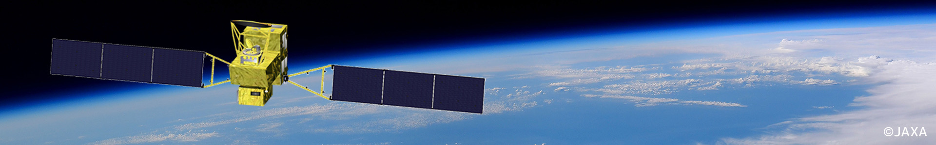
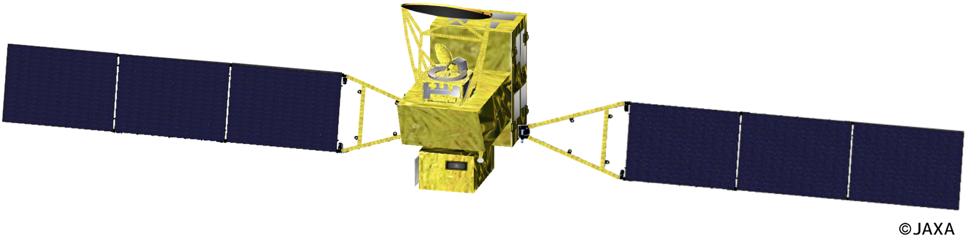
The GOSAT-GW satellite is a medium-sized (2.6 t) spacecraft with a power generation capability of 5.0 kW and was launched by the H-IIA rocket from JAXA's Tanegashima Space Center at June 29th 2025. Its orbit is sun-synchronous at an altitude of 666 km with a repeat cycle of 3 days, same as GOSAT. It ascends from south-east to north-west in the daytime, and its local equator crossing time is 1:30 pm.
GOSAT-GW will carry a grating imaging spectrometer named TANSO-3. GOSAT and GOSAT-2 carry Fourier Transform Spectrometer (FTS) in favor of the high spectral resolution in the wide spectral range from the near infrared to the thermal infrared regions. In the case of TANSO-3, gratings were chosen instead of FTS to realize imaging of greenhouse gas concentrations with a smaller footprint and a wider swath than FTS, which is necessary for emission source observations.
TANSO-3 will observe CO2 and CH4, two major greenhouse gases, and NO2. The NO2 information will be utilized to locate CO2 emission sources by fossil fuel burning and obtain the precise shape of plumes emitted from the sources. TANSO-3 will have three spectral bands: Band 1 at around 0.45 µm for NO2, Band 2 at around 0.76 µm for O2, and Band 3 at around 1.6 µm for CO2 and CH4. These gases cause distinct absorption features in the sunlight reflected at the land or ocean surface and observed by TANSO-3. Through the detailed characterization of these physical features using mathematical methods such as "optimal estimation," the column abundances of these gases (CO2 and CH4) and surface pressure will be obtained. These data will be finally converted to column-averaged dry-air mole fractions of CO2 and CH4 (XCO2 and XCH4, respectively). The column amount of NO2 will be calculated from the conventional Differential Optical Absorption Spectroscopy (DOAS) approach. Bands 1 and 2 will also be used for cloud detection. Solar Induced chlorophyll Fluorescence (SIF), an important indicator of photosynthetic activity of the terrestrial vegetation, will be obtained from Band 2 data.
| GOSAT | GOSAT-2 | GOSAT-GW | |
|---|---|---|---|
| Launch / lifetime | 2009 / 5 years | 2018 / 5 years | FY2025 / 7 years |
| Satellite mass / power | 1.75 t / 3770 W | 1.8 t / 5000 W | 2.6 t / 5200 W |
| Orbit | 666 km, 3 days, 13:00, descending |
613 km, 6 days, 13:00, descending |
666 km, 3 days, 13:30, ascending |
| Spectrometer | TANSO-FTS | TANSO-FTS-2 | TANSO-3 (Grating) |
| Major targets | CO2, CH4 | CO2, CH4, CO | CO2, CH4, NO2 |
| Spectral bands | 0.7 / 1.6 / 2 µm + TIR | 0.7 / 1.6 / 2 µm + TIR | 0.45 / 0.7 / 1.6 µm |
| Spectral Resolution (Sampling interval) |
0.2 cm-1, (≈ 0.01 nm @ 0.7 µm, ≈ 0.05 nm @ 1.6 µm) |
< 0.5 nm @ 0.45 µm, <0.05 nm @ 0.7 µm, < 0.2 nm @ 1.6 µm |
|
| Swath | Discrete, 1 – 9 points | Discrete, 5 points | Selectable, 911 km (Wide) or 90 km (Focus) |
| Footprint size, nadir | 10.5 km | 9.7 km | Selectable, 10 km (Wide) or 1 – 3 km (Focus) |
| Pointing | ±20 /±35 deg (AT/CT) | ±40 /±35 deg (AT/CT) | ±40 /±34.4 deg (AT/CT) |
| Other instruments | CAI (Cloud and Aerosol Imager) | CAI-2 (Cloud and Aerosol Imager 2) | AMSR3 (Advanced Microwave Scanning Radiometer 3) |
GOSAT-GW will also carry AMSR3, a sensor for observing microwave signals emitted from the land, ocean, and atmosphere. It is a successor to AMSR, AMSR-E, and AMSR2 which were launched on board JAXA's ADEOS-II (2002–2003), NASA's Aura (2002–), and JAXA's GCOM-W1 (2012–) satellites respectively. The obtained data will be used to estimate temperature and water-related parameters of the Earth, such as precipitation, water vapor profiles, sea ice, and soil water content. For more details, see below.
TANSO-3 will observe sunlight reflection when the satellite is in the dayside of Earth. During the nighttime, TANSO-3 will collect calibration data occasionally.
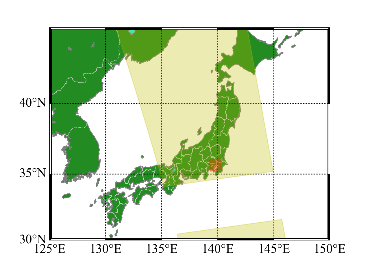
TANSO-3 will have two imaging modes: Wide Mode and Focus Mode. In Wide Mode, TANSO-3 will be operated in push-broom mode with its footprint size and swath of 10 km and 911 km, respectively. The observation will be made in a nadir direction.
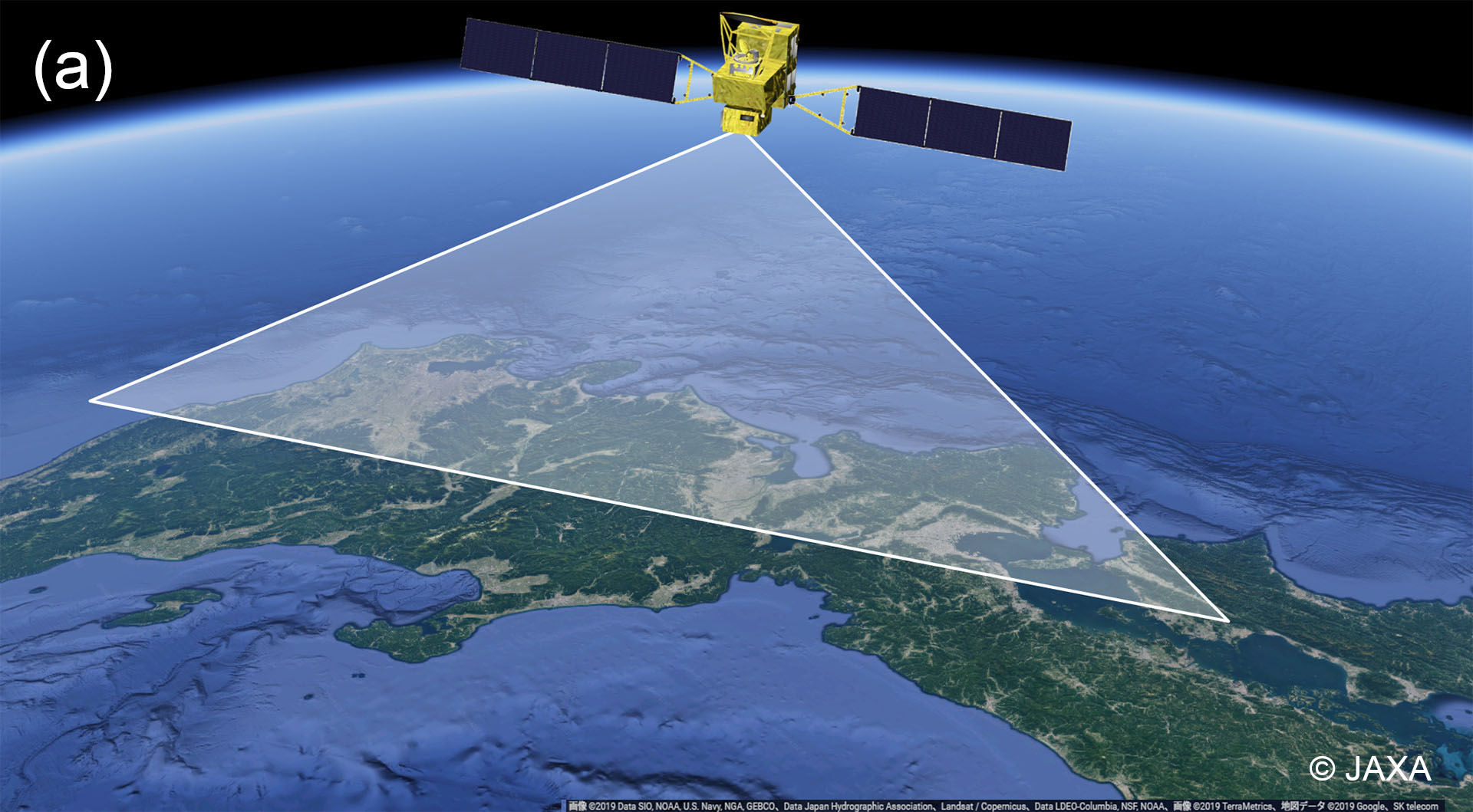
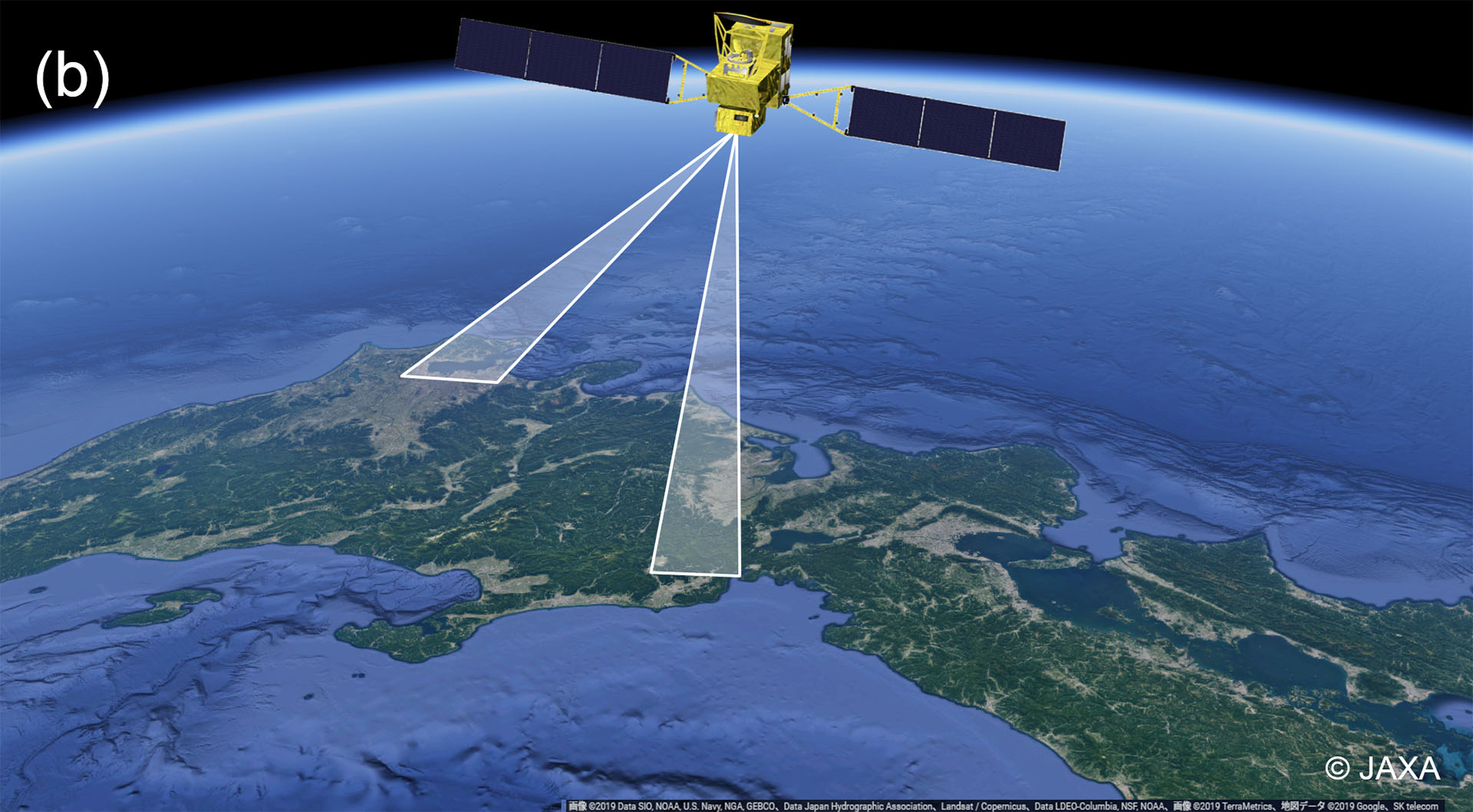
In Focus Mode, the nominal swath width will be 90 km, and the target footprint size, i.e., the maximum resolution to be achieved, will be set for 1 km (note that the size can be switched to 2 km or 3 km as needed). TANSO-3 will have a very agile pointing system to change the location of Focus Mode observation. This pointing system enables TANSO-3 to change its observation direction within ±40 degrees in the along-track direction and ±34.4 degrees in the cross-track direction to observe targets that are not located just beneath the satellite.
The default observation mode of TANSO-3 will be Wide Mode, whereas Focus Mode observation will be made based on observation requests from specified users. Focus Mode observations are expected to target at urban regions such as C40 cities and large emission sources such as power plants and oil/gas facilities, in addition to validation sites. The procedure for requesting an observation will be defined separately and posted on this website. TANSO-3 will have optional imaging capabilities in Focus Mode with smaller footprint sizes.
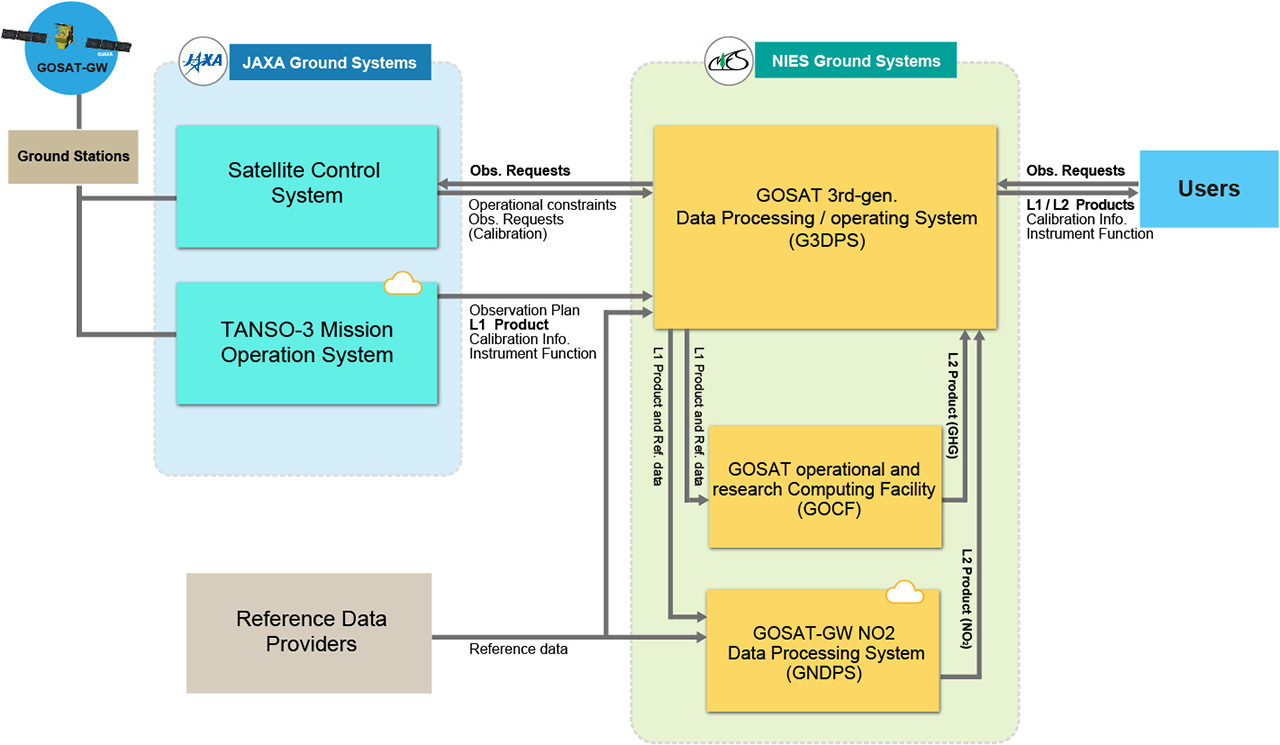
TANSO-3 observation data will be transmitted by the GOSAT-GW satellite to JAXA via ground stations in the Arctic region. JAXA will generate TANSO-3 Level 1 products which contain spectral radiance data at the top of the atmosphere, and transfer them to NIES. The gas amount and concentration products generated at NIES will be categorized as "Level 2 products". NIES plans to generate monthly-basis Level 2 products for Wide Mode and Focus Mode, which contain XCO2, XCH4, SIF, NO2, etc. "Quick Delivery" Level 2 products, which are less accurate but distributed faster than monthly-basis products, are also planned to be generated for a limited number of Focus Mode observations.
TANSO-3 standard products, both Level 1 and Level 2, will be available for free from NIES. Details will be described in TANSO-3 Data Policy.
NIES ground systems for the GOSAT-GW TANSO-3 mission mainly consist of three systems:
C40: https://www.c40.org/